
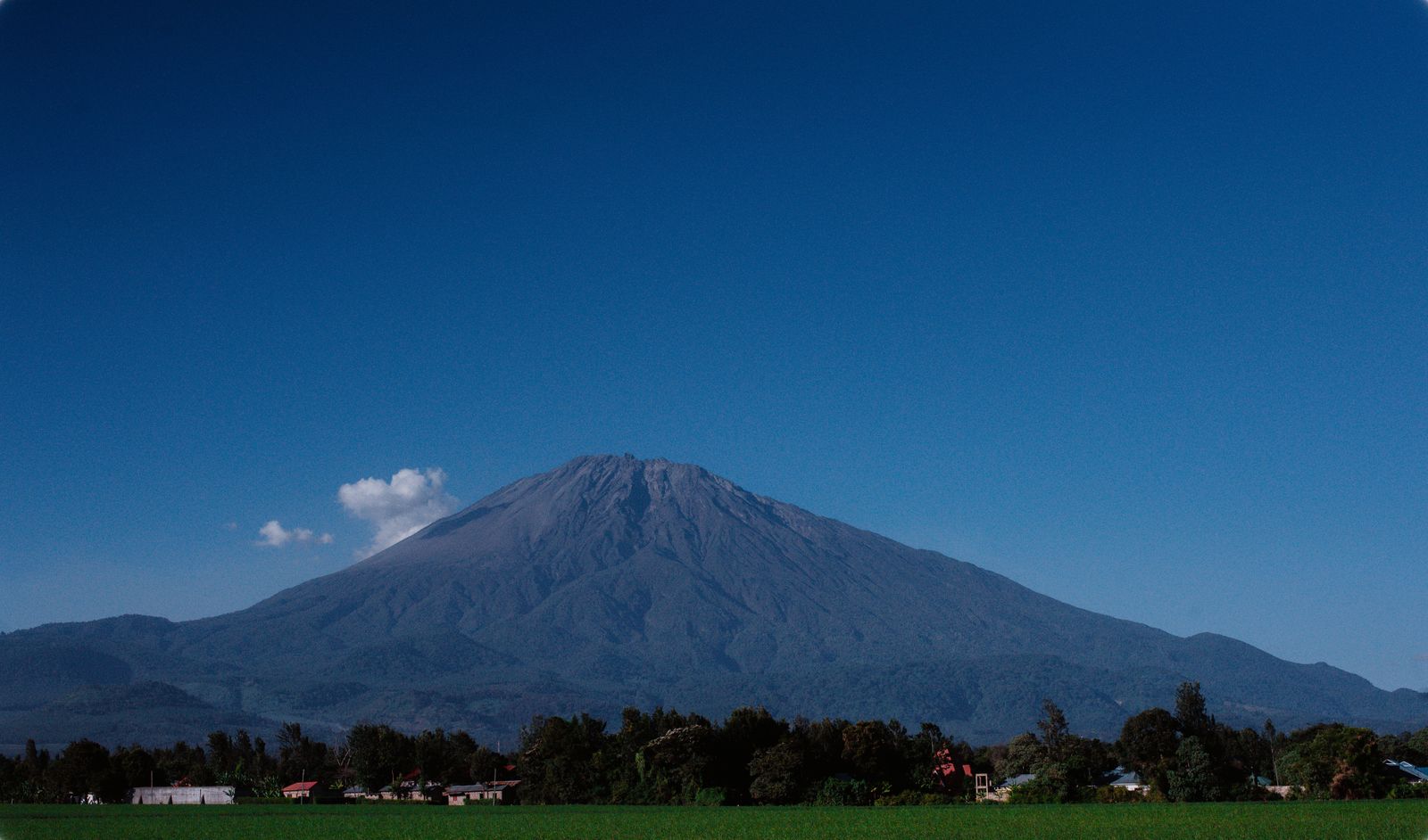
Mount Kilimanjaro is located in northeastern Tanzania, near the border with Kenya in East Africa. It is the highest mountain in Africa, standing at 5,895 meters (19,341 feet) above sea level. The mountain is a popular destination for trekkers and climbers from around the world, known for its stunning landscapes and distinct ecosystems, ranging from tropical rainforest at the base to alpine deserts and glaciers at the summit. Kilimanjaro is part of Kilimanjaro National Park, a UNESCO World Heritage site.
Geographic Location of Mount Kilimanjaro
-
Coordinates:
- Latitude: 3°4′33″S
- Longitude: 37°21′12″E
-
Country: Tanzania
-
Region: Kilimanjaro area
-
Districts: Moshi Rural, Rombo, Hai
-
Proximity to primary cities
- Moshi: Approximately forty kilometres (25 miles) southeast of Kilimanjaro.
- Arusha: About eighty kilometres (50 miles) southwest of the mountain.
- Dar es Salaam: The most important metropolis in Tanzania, approximately 550 kilometres (340 miles) to the southeast.
-
Airports’ accessibility
- For worldwide travellers, the most convenient airport is Kilimanjaro International Airport (JRO), situated about 40 kilometres (25 miles) southwest of the mountain.
-
Highways
- From Arusha: Moshi is the starting point for a well-maintained road that leads to the main entrances of Kilimanjaro National Park.
- From Moshi: Roads connect Moshi to the Marangu and Machame Gates, primary starting places for Kilimanjaro hikes.
-
Geography of the Surrounding National Park
- The mountain and its surroundings are protected by Kilimanjaro National Park, which includes a variety of ecosystems at different elevations.
-
Associated Nations
- Kenya: Although Kilimanjaro is entirely within Tanzania, it is located close to the Kenyan border.
-
Topographical Features
- Elevation: Reaching 5,895 meters (19,341 feet) above sea level, Uhuru Peak is the highest peak on Kilimanjaro.
- Three volcanic cones: Kibo (the highest), Mawenzi, and Shira can be found atop the mountain.
-
Zones of Climate
- Tropical Forest: At the foot of the mountain is lush, varied flora and fauna.
- Moorland: Mid-altitudes are home to endemic plants and enormous heather.
- The Alpine Desert: At high altitudes, there is little vegetation and sharp temperature swings.
- Peak: Arctic conditions exist due to climate change, with ice and snow especially at the top. Glaciers are retreating.
-
Significance: Historical and Cultural Relevance
- National Symbol: Kilimanjaro is regarded as a symbol of Tanzanian pride and has a special place in Tanzanian culture.
- Maasai People: Indigenous people who live in the surrounding areas and have a strong cultural bond with the mountain.
-
Travel
- Major Attraction: Climbers and nature lovers from all over the world visit Kilimanjaro, a popular tourist destination.
-
Close-by Landmarks
- Amboseli National Park: Known for its views of Kilimanjaro, Amboseli National Park is situated in Kenya, roughly 70 kilometres (43 miles) to the north.
- Lake Chala: A crater lake on the eastern slopes of Kilimanjaro that shares a border with Kenya and Tanzania.
- Lake Jipe: This lake, fed by streams from Kilimanjaro, is located southeast of Tanzania and Kenya.
Details of Geography and Climate
-
Temperature
- Rainfall: The southern and eastern slopes receive more rainfall than the northern and western slopes due to prevailing winds. March through May (long rains) and November through mid-December (short rains) are the rainy seasons.
- Temperature Variation: Large temperature ranges exist, from tropical at the base to arctic at the summit. Nights can be bitterly cold, particularly at elevations over 4,000 meters (13,123 feet).
-
The diversity of life
- Flora: The region consists of alpine deserts with little vegetation, heathlands with enormous groundsels and lobelias, and montane forests with juniper and camphorwood.
- Fauna: Home to several species of antelope, buffalo, leopards, monkeys, and elephants. Birds include the Alpine Chat, the Malachite Sunbird, and several raptors.
Trekking Routes and Ecological Zones
-
Zones of Ecology
- Cultivated Zone: Plantations of bananas and coffee are located at the base.
- Rainforest Zone: A haven for a wide variety of animals and plants, rich in biodiversity.
- Heath and Moorland Zone: Characterized by huge heathers and vegetation resembling heaths.
- Highland Desert Zone: Volcanic rocks and sparse vegetation.
- Arctic Summit Zone: Composed of snow and ice, including the well-known Furtwangler Glacier.
-
Hiking Routes
- Marangu route: Known as the “Coca-Cola” route, it is the simplest route with hut accommodations.
- Machame route: Referred to as the “Whiskey” route, it offers various surroundings and camping.
- Lemosho route: One of the most scenic and least crowded routes, presenting gradual acclimatization.
- Rongai route: The handiest route that approaches from the north, near the Kenyan border.
- Northern Circuit route: The longest route, presenting 360-degree views of the mountain.
- Umbwe route: The shortest and steepest route, recommended for experienced climbers.
